Unit Two: Expanding Zones of Exchange and Encounter (500 C.E. to 1200 C.E.)
The spread of Christianity and the importance of geographic location and trade led to the emergence of the Byzantine Empire and its history can be leaned from this handout. Location and defense from invaders are essential to any society and an excellent example is shown with the city of Constantinople map. Art and architecture are excellent indicators to the wealth of a society and one example is seen with the Hagia Sophia where I have shown its glory in a presentation of pictures. History teaches us that all great empires eventually come to an end and the Byzantine Empire was no exception. The attached covers a summary of the Rise and Decline of the Byzantine Empire in a short handout.
The were known as Norsemen or Men from the North. Today the region is called Scandinavia but in early history it was home to a unique society who some historians call culturally advanced while others call them barbarians. Who were the Vikings? The answer to this question is found in the attached short lesson.
With the collapse of the Roman Empire, the Roman Catholic Church moved to the region we known today as Germany and the Holy Roman Empire was created under the Empire of Charlemagne. A better understanding of this progression is seen with the Frankish Rulers and the rise of the Christian church lesson.
The Crusades were a series of holy wars that took place during the Middle Ages. To study these events, there are several documents key to understanding the historical contexts. First is a map showing the Spread of Islam as a cause for the Crusades. The need for a crusade is seen in a speech made by Pope Urban II in Clermont, France. A summary of which is found in the Call for a Crusade handout. An in-depth view of the events can be found in the Crusades lesson and in addition I have added a map of the Crusades which is an integral document that validates the printed lesson. I have created a blank worksheet which can be used to summarize and simplify the Causes and Effects of the Crusades.
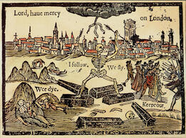
During the Crusades there was a major outbreak of the Black Death across Europe. Historians differ as to its origin and spread but this handout shows the large-scale effects of the Bubonic Plague.
During the Crusades there was a major outbreak of the Black Death across Europe. Historians differ as to its origin and spread but this handout shows the large-scale effects of the Bubonic Plague.
Medieval Europe
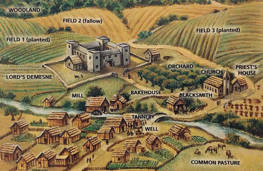
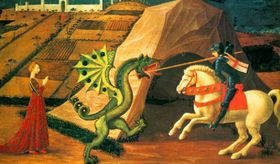
The Middle Ages was a time that saw feudalism, a self-sufficient society and agricultural based society. It was a system based on loyalty to ones lord and king but somewhat mythological as it involved knights in shining armor and damsels in distress! To better explain, the following is a lesson on Feudal Society in Western Europe and it is accompanied by a very important download showing how the manor system worked with a detailed drawing of the manor system. Myths, legends, and romanticism were part of the culture during the Middle Ages. The dream of being a knight in shining armor rescuing a beautiful princess from a castle and slaying a dragon is just a story. Knights were crucial to the safety of society and this handout called How You Became a Knight details the steps that one had to take to become a protector of the country.
Medieval Europe
The Middle Ages was a time that saw feudalism, a self-sufficient society and agricultural based society. It was a system based on loyalty to ones lord and king but somewhat mythological as it involved knights in shining armor and damsels in distress! To better explain, the following is a lesson on Feudal Society in Western Europe and it is accompanied by a very important download showing how the manor system worked with a detailed drawing of the manor system. Myths, legends, and romanticism were part of the culture during the Middle Ages. The dream of being a knight in shining armor rescuing a beautiful princess from a castle and slaying a dragon is just a story. Knights were crucial to the safety of society and this handout called How You Became a Knight details the steps that one had to take to become a protector of the country.
Mesoamerica
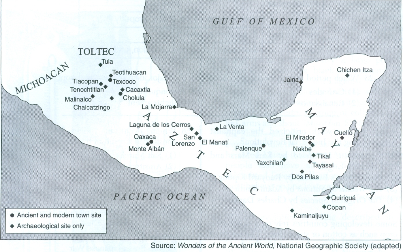
The final part of this unit returns to the Americas and a study of three great civilizations, the Aztecs, Maya and Incas. to study these people I have added a map of Mesoamerican city-states and a handout that shows a comparison of the Aztec, Inca and Mayan civilizations in the form of a simple chart. Special focus is given to two of these civilizations. First is a basic lesson on the Inca Empire which is followed by the World of the Maya presentation that includes some of my own photographs.
Mesoamerica
The final part of this unit returns to the Americas and a study of three great civilizations, the Aztecs, Maya and Incas. to study these people I have added a map of Mesoamerican city-states and a handout that shows a comparison of the Aztec, Inca and Mayan civilizations in the form of a simple chart. Special focus is given to two of these civilizations. First is a basic lesson on the Inca Empire which is followed by the World of the Maya presentation that includes some of my own photographs.
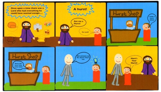
The above cartoon was created by one of my ninth grade students as part of her Middle Ages newspaper project.
She definitely earned the bonus point for creativity!
FYI - a Hurst is a clump of trees or a small wood in Ye Olde English.
She definitely earned the bonus point for creativity!
FYI - a Hurst is a clump of trees or a small wood in Ye Olde English.