Unit Three: Global Interactions (1200 C.E. to 1650 C.E.)
Cultures and traditions in certain regions stay the same for long periods of time. Isolationism often prevents technology and advancement while cultural interactions create more diverse societies. This unit contains both of these concepts.
Self-sufficiency and isolationism led to a Feudal Japan and information about this area of Asia can be found in the attached lesson. Japan is famous for their ancient warriors and the attached drawing illustrates the clothing and armament of a samurai warrior. The religions and belief systems of Japan strongly believe in harmony with nature. The first presentation contains several of my own photos of the ornamental Japanese Gardens that were taken in Brooklyn, New York which is based on Shinto beliefs. The second set of photos were taken at the Morikami, a Buddhist style garden, located in Delray Beach, Florida.
The largest land-based empire of all time belonged to the Mongol Empire and to validate this handout is a map of the Mongol Empire. Their social, political, and economic effects are shown in the handout on the impact of the Mongol Empire rule. It was during this time period that the adventures of Marco Polo took place and this extract tells of his discovery of paper money used by the Chinese under Mongol rule.
In addition to Marco Polo, two other notable people told of their stories. The first are the travels of the Buddhist Monk Xuanzang across Asia whose writing provided incredible insight as to the different societies that he visits on his journeys. The second traveler is more famous. The attached is a primary source extract with key questions on the explorations of the Muslim traveler Ibn Battuta. Berkeley ORIAS which is part of UC Berkeley, Office of Resources for International and Area Studies has created an outstanding website dedicated to Ibn Battuta. Not only does it cover his travels but it expands in details on the various cultures of the regions along with maps, pictures and videos. I have created a special series of questions based on the different sections of this site. The link to the special assignment on Ibn Battuta, A Virtual Tour, is a vital resource for all students to spend quality time on as it explains in depth society and their customs prior to the domination by European countries after 1450 C.E.
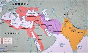
The period from about 1450 to 1650 is sometimes called "the age of gunpowder empires" because of the Ottoman, Mughal, and Safavid Empires used new military technology. The following three handouts cover these empires. The first is called The Gunpowder Empires and covers all of the three empires. The second handout is a comparison of The Ottoman and Safavid Empires. The final handout is an in-depth look at the third gunpowder empire; the Mughal Empire including their accomplishments and the reason for their decline.
Another area of study in this unit covers the regions and areas of Southeast Asia and I have added a map of this area showing the location relative to East Asia as well as the key geographic features. To expand on the above map is a handout that covers the Kingdom of Pagan, the Khmer Empire, and the Srivijaya. This handout called The Diverse Traditions of Southeast Asia covers their regions of power and their accomplishments.
Africa
We do not fully understand the actual size of the continent of Africa. Our world maps are drawn to fit everything in an easy to understand format. To better understand the distinct geographical and cultural regions of the continent I created This is Africa presentation and to further illustrate this download I have added a Climate of Africa map. A key are of focus in this unit is the Early civilizations of West Africa lesson and it is supplemented by a map of early African civilizations. Trade was a very important way of life in this region. It brought wealth, cultural diffusion, and religion. The gold and salt trade was especially important to West Africa and the following handout called Salt Traders focuses on the need for trans-Saharan trade.
The Indian Ocean Trade routes are a key area to study and a this presentation on the Muslim Trade routes details and explains the scope and size of these trading perimeters. In addition, this link opens to a Map of the Muslim Trade Routes. Included in this region are the ancient East African kingdoms and this handout gives information and photographs as to their existence and importance to the continent.
The Renaissance
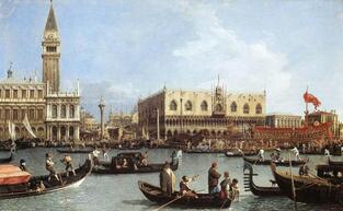
The word Renaissance is French in origin and basically means a rebirth of old ideas and takes place between 1300 C.E. and 1600 C.E. The Italian Renaissance lesson shows the causes and effects of this important time in Western European history and is accompanied by a second document on the achievements of the Renaissance. This era is probably best known for its human creative skills and interpretation of events and is best shown through a sample of pictures Art of the Renaissance and then an in-depth presentation of Art during the Renaissance.
The Scientific Revolution handout is important to the social, religious and political changes that take place after the Renaissance and a key event to this change takes place with the Protestant Reformation. During this time period is a dramatic change within the Christian church and to better understand I have added a link showing Key People in the Christian church in the form of a chart and a document called Divisions within the Protestant church , a handout that simplifies the key Protestant sects. To end the unit I have added a Religions of Western Europe map and a basic chart on Christian Religions, Beliefs and Practices.